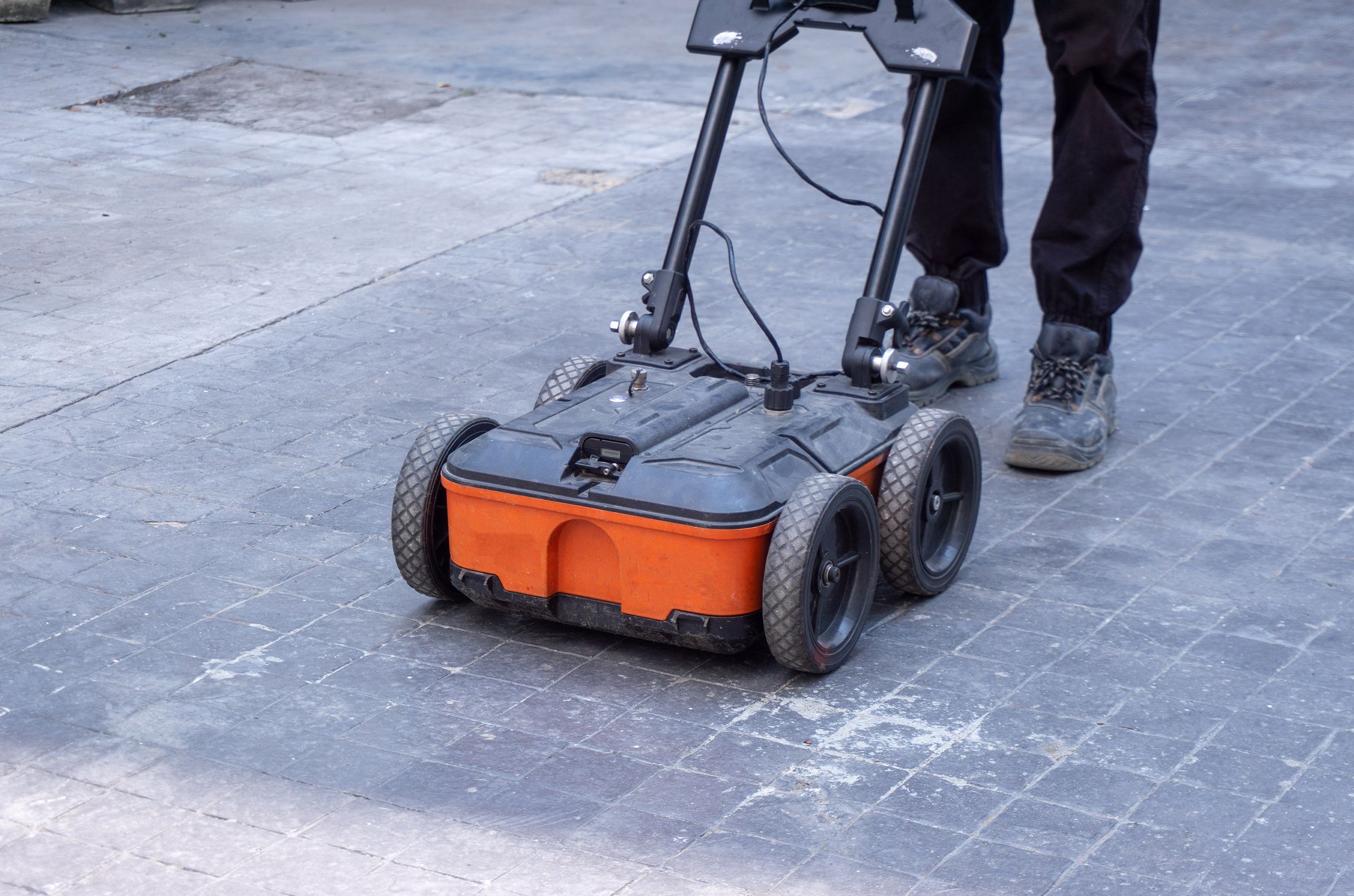
Person operating an orange ground-penetrating radar machine with four wheels on a concrete surface.

Ground Penetrating Radar: Seeing Beneath the Surface with NDT

Discover the advantages of ground penetrating radar (GPR), understand the basic principles behind the GPR method, and explore the variety of techniques for applying GPR in nondestructive testing across industries.

What Is Ground Penetrating Radar and How Is It Used in NDT?

Ground penetrating radar (GPR) is an NDT method that uses short pulses of radio waves to create images of what is beneath a surface. When a radio wave pulse hits a boundary between two materials with different electrical properties—like soil and rock, or concrete and a buried pipe—part of the wave reflects back to the antenna. The system measures the timing and strength of these reflections to build a picture of subsurface features and conditions.

GPR works in a wide range of materials, including soil, concrete, asphalt, and rock. It can locate buried utilities, rebar, post-tension cables, voids, and other features without drilling or excavation.

A qualified NDT professional uses their knowledge of radar wave behavior, antenna selection, and data interpretation to plan surveys, conduct scans, and analyze the results.

The main goals of GPR in industrial and civil applications include:

  • Locating Buried Objects: GPR is widely used to find things like pipes, cables, rebar, and other objects hidden beneath pavement, concrete, or soil.

  • Measuring Thickness: By tracking how long it takes for signals to travel down and bounce back, GPR can measure the thickness of pavement layers, concrete slabs, and other structures.

  • Assessing Condition: GPR can help identify hidden problems like voids beneath a road, moisture trapped in insulation, or corrosion-related changes inside a concrete structure.

Advantages and Limitations of Ground Penetrating Radar in NDT

GPR is used across industries from construction and civil engineering to utilities, environmental studies, and transportation. Before considering GPR for an application, it helps to understand the main advantages and limitations of the method.

Advantages of Ground Penetrating Radar

  • Sees Below the Surface: GPR reveals what is happening underground or inside a structure, helping users find hidden features and problems without excavation or destructive testing.

  • Non-Invasive and Safe: GPR uses low-power radio waves. There are no radiation hazards and no need for chemicals or couplants.

  • Works in Many Materials: GPR is effective in soil, concrete, asphalt, and rock, making it useful for a wide range of inspection tasks.

  • Portable and Fast: Most GPR systems are compact and mobile. Surveys can be done quickly in the field without special setup.

  • Real-Time Results: GPR provides immediate feedback, so users can make decisions on the spot or adjust their survey plan as they go.

  • Detailed Data: Modern GPR systems can produce detailed displays and maps of subsurface features to support interpretation and reporting.

Limitations of Ground Penetrating Radar

  • Soil and Material Conditions: Wet clay, salty soils, and other highly conductive materials absorb radar energy quickly, reducing the depth of penetration.

  • Surface Access Required: GPR needs to be moved across the surface being scanned. Dense vegetation, debris, water, or rough terrain can make this difficult.

  • Interpretation Takes Experience: GPR data can be complex. Telling the difference between a buried pipe and a natural rock layer, or between a void and a change in soil type, requires trained judgment.

  • Depth vs. Detail Tradeoff: Higher-frequency antennas see more detail but cannot reach as deep. Lower-frequency antennas penetrate deeper but produce less resolution.

  • Cannot Identify Materials Directly: GPR shows where something is and how big it is, but it cannot tell you what material it is made of. Additional testing or investigation may be needed.

  • Setup and Calibration: Reliable results depend on choosing the right antenna, using appropriate settings, and planning the survey for the specific material and target.

How Ground Penetrating Radar Works: Basic Principles

GPR detects changes between materials or regions with different electrical properties, rather than showing a direct photograph of what is below the surface.

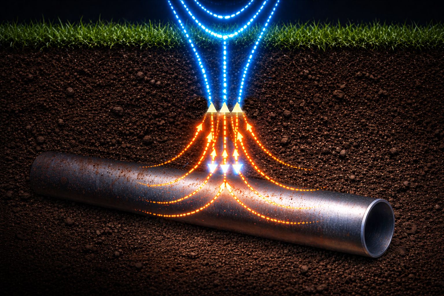
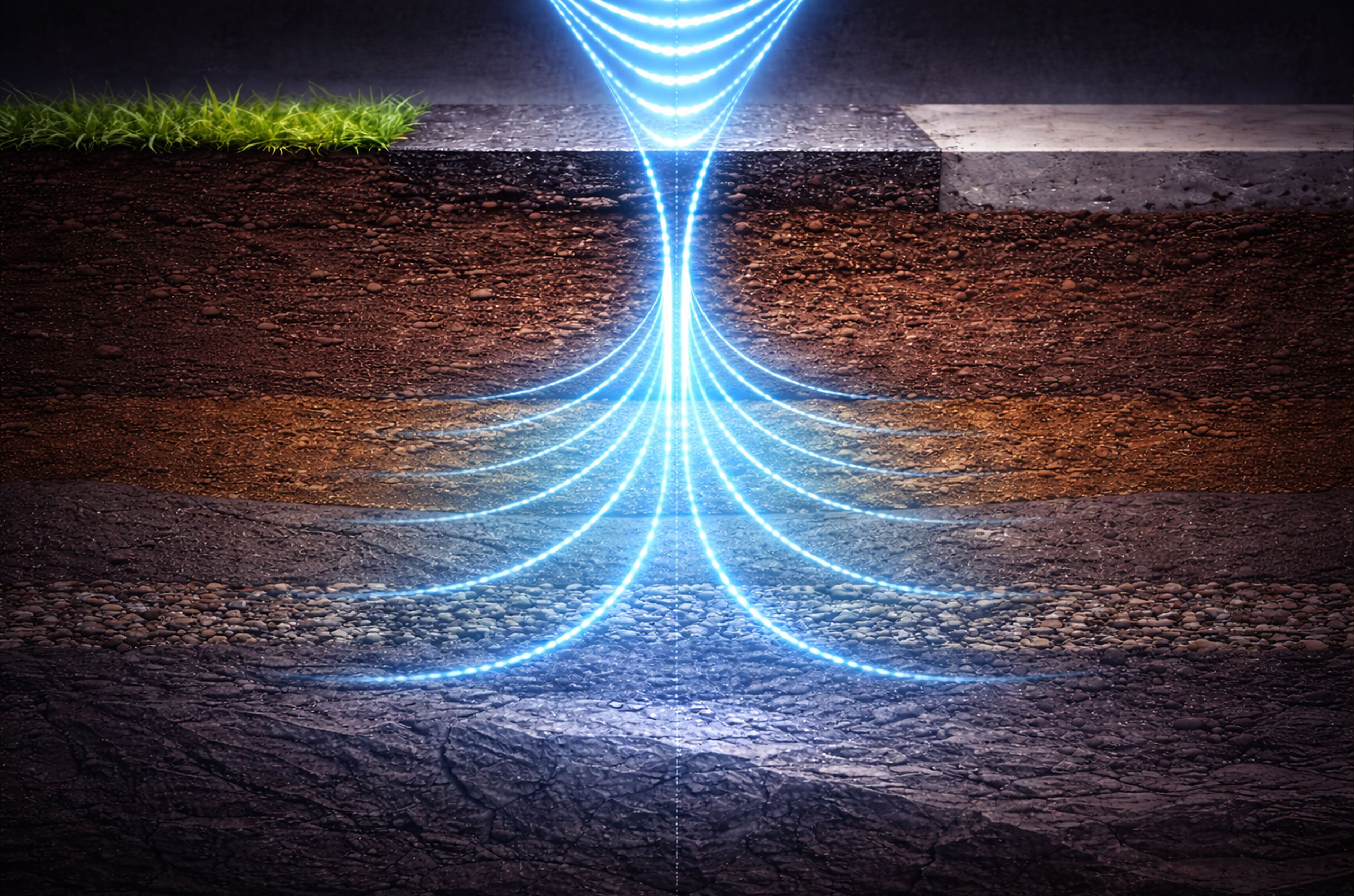
A GPR system works by moving an antenna across a surface. As it moves, the antenna sends short pulses of radio wave energy into the material below. When a pulse crosses a boundary between two materials with different electrical properties, part of the energy reflects back to the receiving antenna.

The system records how long each reflection takes to return and how strong it is. A technician or software system then uses this timing and amplitude data to calculate the depth and shape of subsurface features.

NDT practitioners use their knowledge of radar wave behavior, antenna selection, and data interpretation to plan surveys, conduct scans, and analyze results for their specific application.
How Radar Waves Interact with Materials

The radio waves used in GPR are much higher in frequency than the signals used for everyday communication. At these frequencies, radar waves interact in predictable ways with the materials they pass through and the boundaries they encounter.

Reflection

When radar waves hit a boundary between two materials with different electrical properties—like soil and a buried pipe, or concrete and an air void—some of the energy bounces back toward the antenna. This reflected energy is what the GPR system detects and records.

Penetration

Radar waves can pass through many materials, including soil, concrete, asphalt, and rock. How deep they penetrate depends on the electrical properties of the material and the frequency of the antenna being used.

Refraction

When radar waves pass from one material into another at an angle, they bend (similar to how a straw appears to bend when placed in a glass of water). This bending effect influences how the signals travel through the subsurface and must be accounted for when interpreting the data.

Why Materials Matter: Dielectric Properties

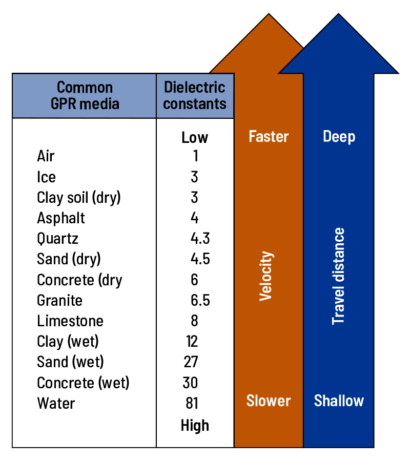
How deep GPR can reach depends largely on the electrical properties of the material being scanned. Every material has a dielectric constant—a number that describes how it interacts with electromagnetic energy. Materials with low dielectric constants, like dry sand or air, allow radar waves to travel faster and penetrate deeper. Materials with high dielectric constants, like wet clay or water, slow the waves down and limit depth significantly.

This is why the same GPR setup can see several meters deep in dry sand but only a fraction of that in wet soil. It also explains why moisture is one of the biggest factors in GPR performance—adding water to any material raises its dielectric constant dramatically.

Chart comparing GPR media dielectric constants, showing velocity and travel distance increase for materials like air, fresh water, and clay.

How Antenna Frequency Affects Results

The frequency of the antenna determines both how deep the radar can reach and how much detail it can resolve. Choosing the right antenna for a given application requires balancing these two factors.

  • Low-frequency antennas (typically below 400 MHz) reach deeper into the ground but produce less detailed images. They are best for geological surveys, deep utility mapping, or applications where depth is the priority.

  • Mid-frequency antennas (around 400–900 MHz) balance depth and detail, making them versatile for general concrete and utility inspections.

  • High-frequency antennas (typically above 900 MHz) produce high-resolution images but cannot reach as deep. They are ideal for thin slabs, shallow utility detection, and detailed structural inspections.

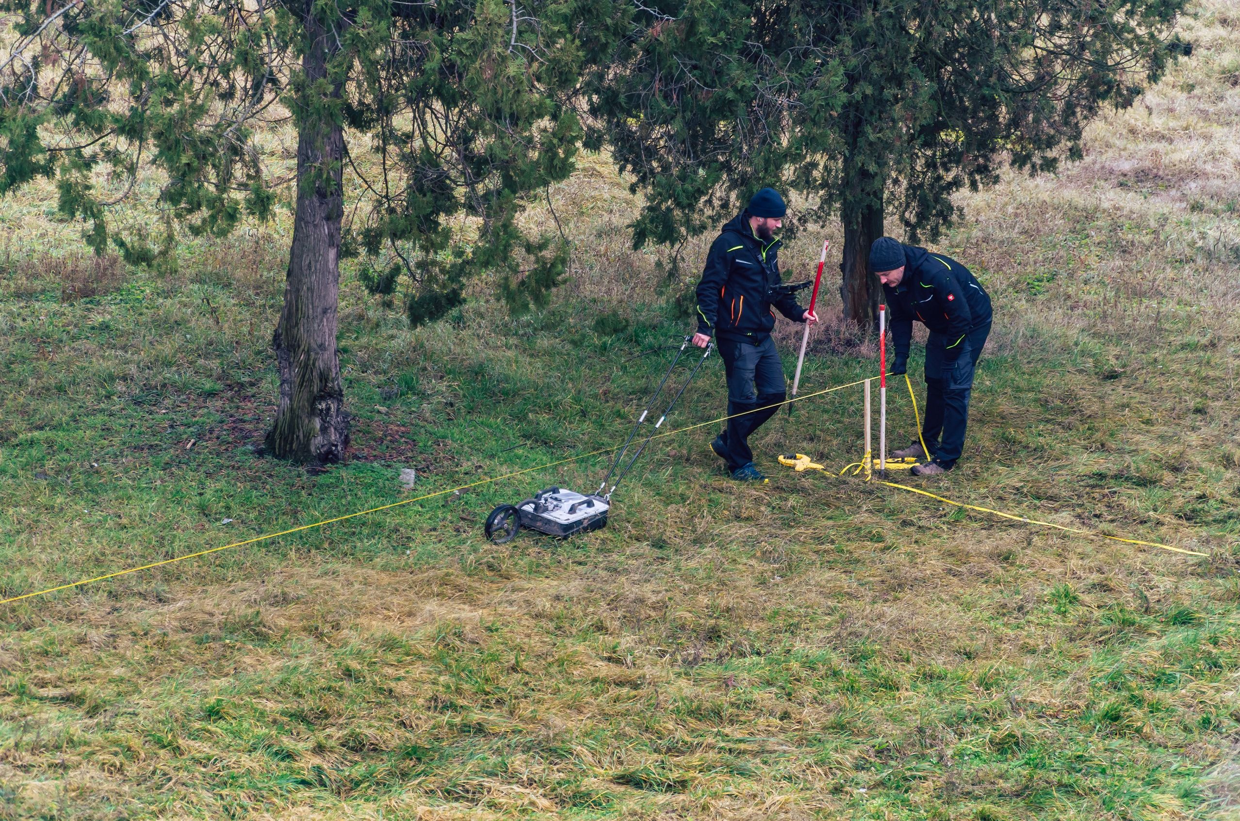
Two people in dark clothing use surveying equipment on a grassy field under trees, with measuring tape and a wheeled instrument.

How Ground Penetrating Radar Is Conducted in NDT

GPR uses different antenna types and survey approaches depending on what is being inspected, how deep the targets are, and what kind of results are needed.

Surface Scanning

  • Ground-coupled scanning is the most common GPR approach. The antenna is placed directly on or close to the surface, maximizing signal strength and depth penetration.

  • Grid scanning runs multiple parallel survey lines across an area to build a three-dimensional map of subsurface features. This approach is standard for concrete slab inspections, utility mapping, and site surveys where thorough coverage is needed.

Air-Launched Scanning

  • Vehicle-mounted systems suspend the antenna above the surface, allowing rapid, non-contact surveys of roads and runways at highway speed. These systems sacrifice some resolution for speed and are primarily used for pavement condition surveys and large-area mapping.

Borehole and Crosshole GPR

  • Borehole GPR lowers an antenna into a drilled hole to investigate subsurface conditions at depth. This is used in geotechnical and environmental applications where surface scanning cannot reach the required depth.

  • Crosshole GPR places antennas in two separate boreholes and measures how signals travel between them. This approach provides detailed information about conditions in the material between the boreholes.

Industry Applications of Ground Penetrating Radar

GPR is used wherever there is a need to see beneath a surface without disturbing it. Its combination of speed, portability, and depth capability makes it valuable in many different sectors.

Energy

In energy-related settings, GPR can be used to inspect concrete structures and to look for buried or embedded features below the surface. This helps inspectors gather information without drilling, excavation, or other destructive methods.

Learn How NDT Is Used in Energy
"A composite image showcasing various energy sources: solar panels in the foreground, oil pump jacks in the middle ground, and wind turbines and a power plant in the background. The scene illustrates the diversity of energy production methods at sunset.

Aerospace

In aerospace-related settings, GPR can support inspections where a surface or structure needs to be examined for hidden features below the surface. It is helpful when a fast, noninvasive scan is needed before deciding whether more testing is required.

Learn How NDT Is Used in Aerospace
A technician performing maintenance or inspection work on the landing gear of a large commercial airplane inside an aircraft hangar. The scene is illuminated with a blue tint, highlighting the aircraft's engines and the structural details of the hangar.

Transportation

In transportation work, GPR can be used on paved surfaces and concrete structures to help locate embedded features, review layer thickness, and identify subsurface conditions that may need further evaluation.

Learn How NDT Is Used in Transportation
A modern high-speed train moving swiftly through a train station at sunset. The motion blur effect emphasizes the train's speed, with vibrant colors in the sky and station lights creating a dynamic and futuristic atmosphere.

Manufacturing

In manufacturing, GPR can help inspectors check whether features inside a material or structure are where they are expected to be. It can also be used to look for hidden changes below the surface without cutting into the part.

Learn How NDT Is Used in Manufacturing
A modern manufacturing facility with robotic arms working on an automated assembly line. The scene is well-lit with blue overhead lighting, showcasing advanced machinery and precision engineering in a clean, industrial environment.

Infrastructure

In infrastructure and construction, GPR is often used on concrete, asphalt, soil, and rock to help locate subsurface features and assess conditions below the surface. This makes it useful for inspection, planning, and follow-up evaluation.

Learn How NDT Is Used in Infrastructure
A large infrastructure project featuring a highway under construction. Several cranes are positioned along the unfinished sections of the elevated roadway and bridge. The scene is set on a clear, sunny day with blue skies and some scattered clouds.

Example: GPR in the Real World

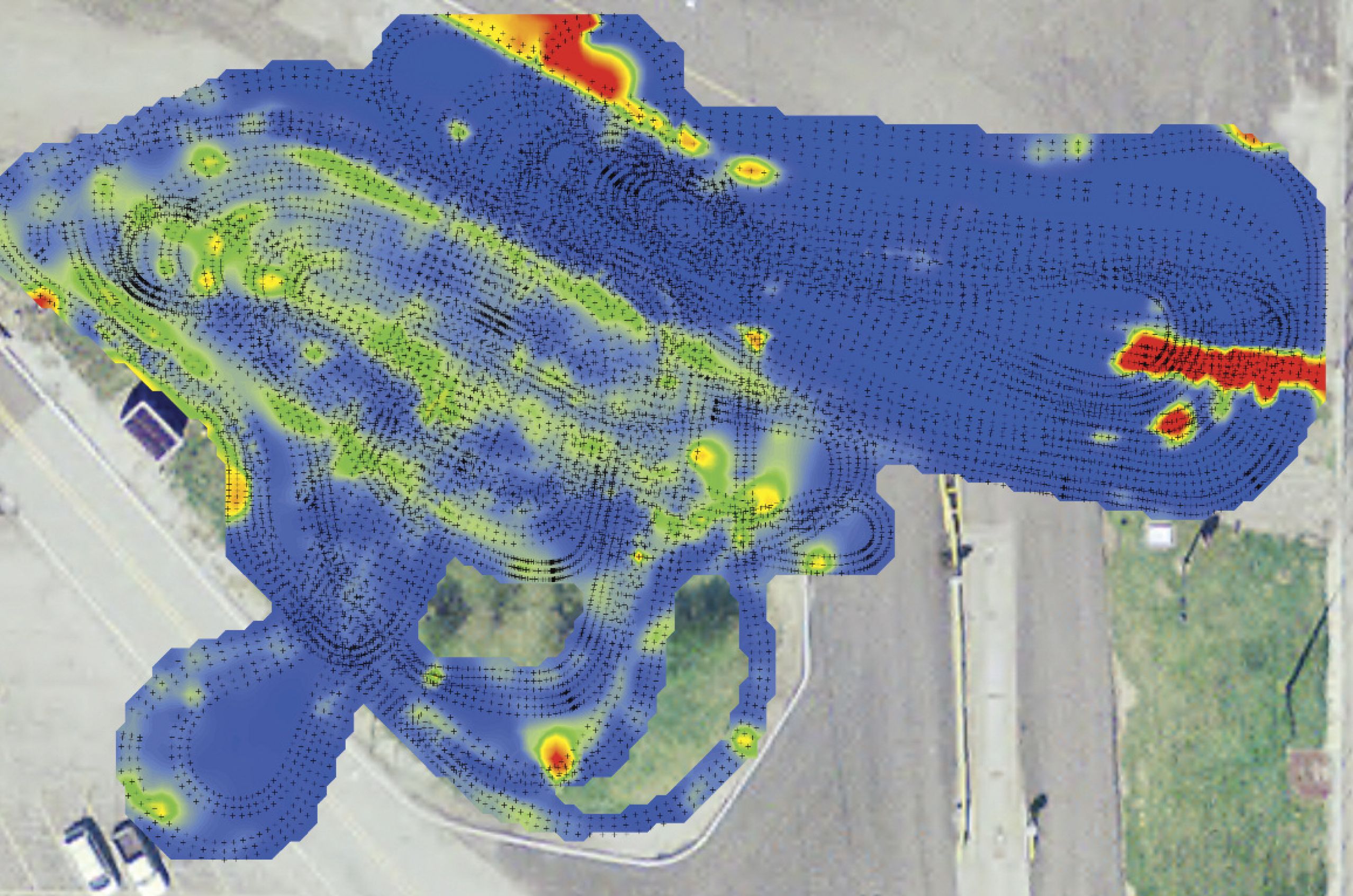
Before any excavation begins on an urban construction project, GPR is typically one of the first tools on-site. Crews use it to scan the area and identify buried utilities—water lines, gas pipes, electrical conduits, communication cables—that could be damaged during digging.

Hitting an unknown utility line can cause service disruptions, safety hazards, and expensive repairs. GPR helps prevent these problems by providing a clear picture of what is below ground before any work begins.

GPR surveys are routinely required by state departments of transportation and municipal agencies to verify subsurface conditions before major roadwork or construction projects.

Ground penetrating radar (GPR) heatmap overlaid on an aerial photograph of a paved site, showing subsurface anomaly intensity across a parking lot or roadway area.

Deeper Learning About Ground Penetrating Radar

Whether you’re building expertise or advancing your career, ASNT supports NDT professionals working in Ground Penetrating Radar through technical resources and publications.

Book

The GPR Compendium: Articles on Ground Penetrating Radar

This compendium is a compilation of technical articles on GPR published in ASNTs Materials Evaluation, Research in Nondestructive Evaluation, and The NDT Technician newsletter from 1999 through 2015. It was compiled at the request of the Ground Penetrating Radar Committee of the ASNT Technical and Education Council in order to provide reference material for the development of the GPR body of knowledge included in ANSI/ASNT CP-105 (2016). The research and findings contained herein offer real-world and laboratory tested insight into the field of GPR and can be useful to a diverse readership. For students, this guide is an invaluable tool toward a greater understanding and overall knowledge of GPR. For the seasoned technician, the compendium serves as a reference that documents articles on the method.

Book

ASNT Level III Study Guide: Basic, 5th ed.

Prepare for the ASNT NDT Level III Basic examination using this comprehensive study guide designed for both ASNT certification candidates and those pursuing Basic Level III exams under employer-based programs. The content and sample questions have been updated to align with the 2024 editions of SNT-TC-1A, CP-189, and CP-105. Included are inquiries and responses from ASNT’s SNT-TC-1A Interpretation Panel for in-depth understanding.

An extensive section is devoted to the general application of 11 different NDT methods, including topical outlines from the 2024 edition of CP-105, references, and method-specific questions and answers. Entire sections from both SNT-TC-1A and CP-189 are provided for convenient reference.

Section III presents questions that follow the second edition of ASNT’s Materials and Processes for NDT Technology, supporting a logical and efficient study experience.

Additional resources include the Code of Ethics for Level III NDT Personnel Certified by ASNT, an overview of the ASNT NDT Level III Program, and handy tables of common units used in NDT, all conveniently located in the appendixes.

This study guide is an essential resource for anyone seeking a thorough and up-to-date preparation for the ASNT Level III Basic examination.

Research Paper

Ground Penetrating Radar for Transportation Infrastructure Applications

GPR is becoming a mainstream application in the toolbox of NDT methods for use in assessing bridge, roadway, and pavement conditions. It will play an important role in the push to restore and rebuild the nation’s transportation infrastructure.

Chat Window Trigger